


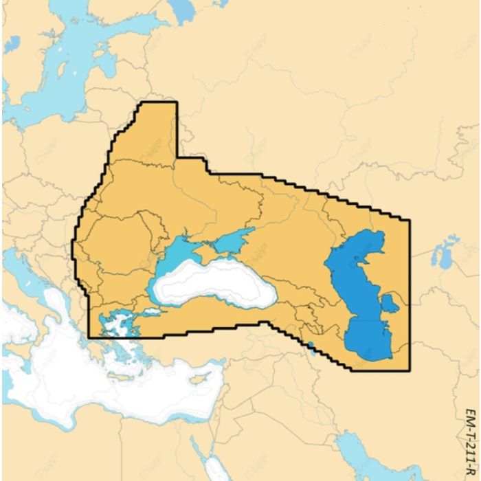
Map Reveal - Black & Caspian Seas

Stock Status: In stock

Note: Only quantities are available in stock. Currently out of stock. Please request a quote.
Description
C-MAP® REVEAL™ X: The Next Generation of Marine Navigation
Step into the future of marine navigation with C-MAP® REVEAL™ X, exclusively designed for Simrad® NSX chartplotters. Experience a fresh, dynamic charting experience that brings the world to life with game-changing Shaded Relief, delivering unparalleled detail both above and below the water.
Key Features
Next Generation Charts: REVEAL™ X offers a clear, clutter-free view, optimized at every zoom level, ensuring you always see the essential data. With best-in-class Day & Night modes, you'll navigate safely and efficiently, regardless of weather or time of day.
Smooth App Integration: Seamlessly connect to the Simrad® Companion App for a fully synchronized experience. Plan trips, review tracks, and plot waypoints on the app, then sync directly to your NSX. The app also provides easy access to NSX manuals, “How To” guides, and more.
Best of C-MAP
Full-Featured Vector Charts: Navigate with confidence using accurate, up-to-date vector charts sourced from official hydrographic offices.
High-Res Bathymetry: Identify crucial underwater features with contours down to 1-foot, enhanced by C-MAP’s top-tier HRB data.
Subscription-Free Autorouting: Automatically generate the safest, most efficient route without worrying about additional costs. C-MAP’s Easy Routing is always subscription-free.
Custom Depth Shading: Tailor your view to highlight specific depths, perfect for enhancing your fishing strategy.
Harbor & Approach Details: Approach any harbor with confidence, armed with detailed information for a smooth docking experience.
Exclusive to REVEAL X
-
Shaded Relief
Immerse yourself in 3D-rendered land and underwater elevations, featuring ultra-high-resolution areas—essential for anglers and divers.
-
Satellite Overlay
Stay connected to your surroundings, even in unfamiliar waters.
-
New Map Inspector Tool
Access the information you need quickly with a simple touch, streamlining your navigation.
-
Tides & Current
Plan your day with detailed water level projections and tidal data.
-
Detailed Marina Port Plans
Docking in an unfamiliar port is made easy with precise layouts of marinas, including slip spaces and restricted areas.
General Specification
No specifications available.
