


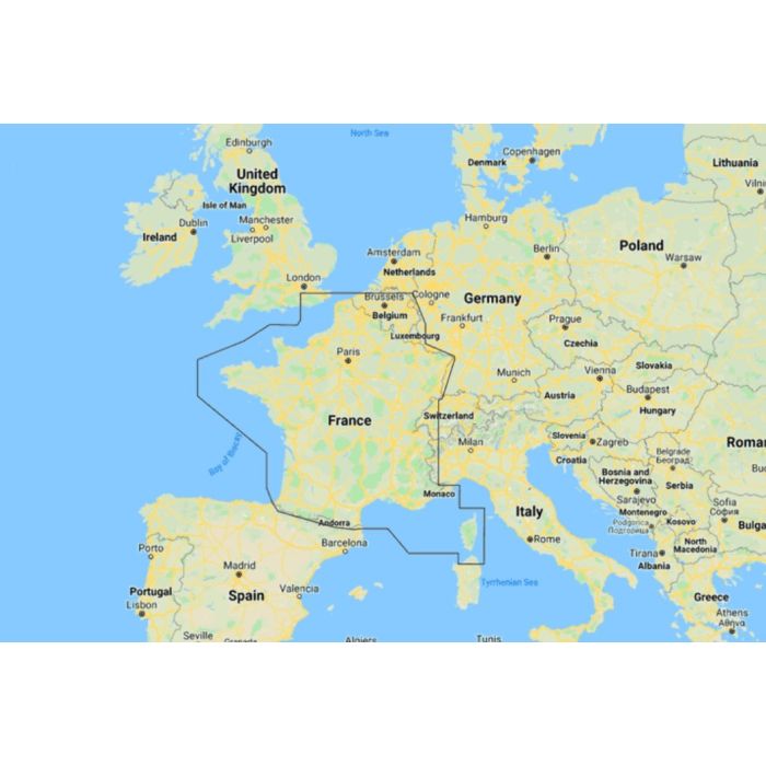
Map Reveal - France Coastal & Inland

Stock Status: Out of stock
Note: Only quantities are available in stock. Currently out of stock. Please request a quote.
Description
C-MAP® REVEAL™ Coastal Charts: The Ultimate Navigation Experience
Whether you're cruising, fishing, or sailing, C-MAP® REVEAL™ Coastal charts provide the pinnacle of marine navigation, combining advanced features with the very best of C-MAP technology. With game-changing Shaded Relief, including Reveal Seafloor Imagery, Aerial Photography, Satellite Overlay, and Dynamic Raster Chart presentation, these charts take navigation to a new level. Built on the core features of DISCOVER™, REVEAL™ Coastal charts also include full-featured Vector Charts, Custom Depth Shading, Tides & Currents, and subscription-free Easy Routing™. Plus, enjoy the highest quality High-Resolution Bathymetry, enhanced by integrated Genesis® data.
Key Features
-
Shaded Relief
Experience the world in 3D with rendered land and underwater elevations, including Ultra-High-Res Bathy seafloor imagery. This level of detail, previously only available in MAX-N+ Reveal, is a game-changer for anglers. -
Full-Featured Vector Charts
Navigate with ease using accurate, up-to-date vector chart details derived from official Hydrographic Office sources, ensuring you always have the most reliable information. -
High-Res Bathymetry
Identify crucial underwater features such as shallow areas, drop-offs, ledges, holes, and humps. The HRB layer now includes compiled and quality-controlled Genesis® data, offering unparalleled detail. -
Custom Depth Shading
Set a clear safety depth, maintain a traditional paper-like chart view, or create your own custom shading to suit your specific navigation needs. -
Dynamic Raster Charts
Enjoy the traditional chart look and feel, enhanced with easy access to all objects on the chart, providing a familiar yet advanced navigational experience. -
Easy Routing™
Automatically plot the shortest and safest route based on detailed chart data and your vessel's specifications, all without a subscription, making navigation stress-free. -
Aerial Photography
Enhance your situational awareness with thousands of high-quality photos of marinas, harbors, inlets, and other key navigational features. -
Satellite Overlay
Getting a better understanding of your surroundings with satellite imagery is crucial when navigating unfamiliar waters. -
Tides & Currents
Plan your day with accurate projections of water levels and tidal currents, essential for safe and efficient cruising, angling, or sailing. -
Detailed Marina Port Plans
Dock confidently in any port with precise layouts of thousands of marinas, including slip spaces, restricted areas, and other important details. -
Harbor & Approach Details
Approach harbors and inlets with confidence using detailed charts that provide the information needed for safe entry and exit, perfect for concluding a long voyage or an exciting day of fishing.
General Specification
No specifications available.
