


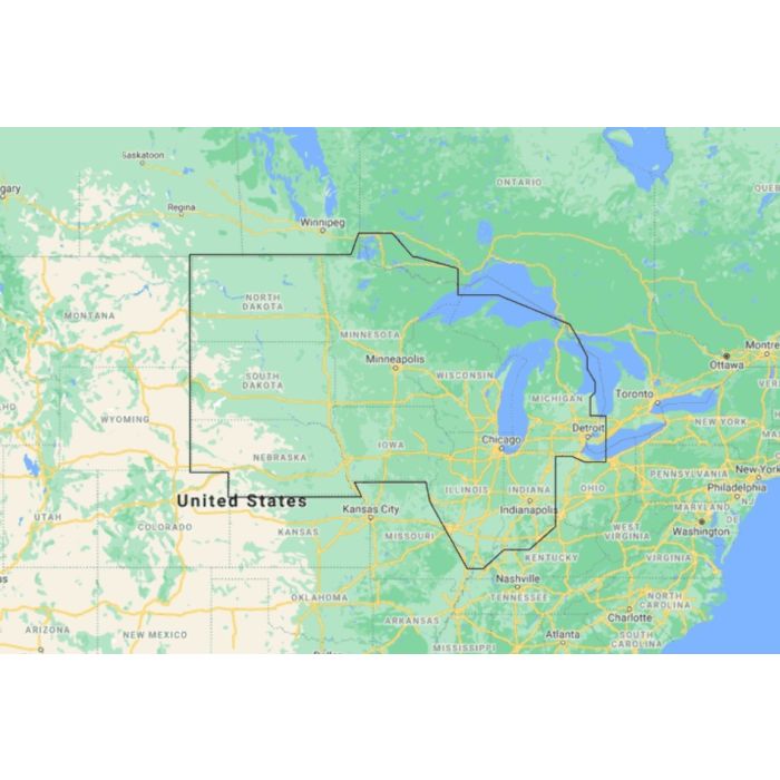
Map Reveal - US Lakes North Central

Stock Status: In stock
Note: Only quantities are available in stock. Currently out of stock. Please request a quote.
Description
C-MAP® REVEAL™ Inland US Lakes North Central: Unmatched Detail for Every Angler
Explore the North Central US lakes like never before with C-MAP® REVEAL™ Inland US Lakes North Central charts. Designed for anglers and boating enthusiasts, these charts bring your favorite lakes to life with game-changing features like Shaded Relief, Reveal Seafloor Imagery, and the most detailed High-Res Bathymetry available. With Aerial Photography, Satellite Overlay, and Dynamic Raster Charts added to the core features of DISCOVER™, you'll have everything you need for a successful day on the water. Your purchase includes 12 months of free online updates, ensuring you always have the latest information.
Key Features
-
Shaded Relief
Experience your lakes in stunning 3D with rendered land and underwater elevations, providing a new perspective on familiar waters. -
Reveal Seafloor Imagery
Gain insights with Ultra-High-Res Bathymetry, revealing submerged structures and contours that are crucial for locating fish. -
Full-Featured Vector Charts
Navigate confidently with accurate, up-to-date vector charts, ensuring you have the best data derived from official sources. -
Custom Depth Shading
Tailor your view by setting clear safety depths or creating custom shading, enhancing your fishing and navigation strategies. -
Aerial Photography
Enhance your situational awareness with high-resolution photos of key locations, including marinas and shoreline features. -
Satellite Overlay
See beyond the water with satellite imagery, providing additional context when navigating or scouting unfamiliar lakes. -
Dynamic Raster Charts
Enjoy the traditional chart presentation, optimized for easy access to all necessary navigational objects. -
High-Resolution Bathymetry
Identify key fishing spots with detailed bathymetric data, highlighting drop-offs, ledges, and other underwater structures. -
Tides & Currents
Although less critical for inland lakes, these features provide insights into water movement, helping you plan your day on the water. -
Easy Routing™
Plot the safest and shortest routes automatically based on your vessel's specifications, with no subscription required. -
Detailed Marina Port Plans
Dock with confidence using precise layouts of marinas, including slip spaces and restricted areas.
General Specification
No specifications available.
