


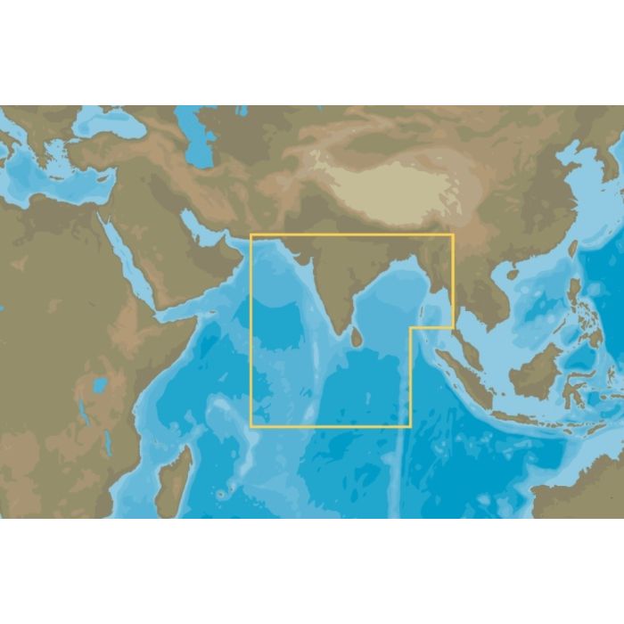
Map Reveal - India, Sri Lanka, Maldives

Stock Status: Out of stock
Note: Only quantities are available in stock. Currently out of stock. Please request a quote.
Description
C-MAP® REVEAL™ Coastal Charts offer a premium navigation experience, whether you're cruising, fishing, or sailing. These charts combine innovative features like Shaded Relief with Reveal Seafloor Imagery, Aerial Photography, Satellite Overlay, and Dynamic Raster Chart presentation, building on the core capabilities of C-MAP DISCOVER™. They include full-featured Vector Charts, Custom Depth Shading, Tides & Currents, and subscription-free Easy Routing™. Additionally, C-MAP REVEAL™ Coastal charts integrate the very best High-Res Bathymetry, including compiled Genesis® data, ensuring you have the most detailed and accurate information. Your purchase includes 12 months of free online updates, and the charts are compatible with Lowrance, Simrad, and B&G Chartplotters.
Key Features
-
Shaded Relief
Experience 3D-rendered land and underwater elevations, including Ultra-High-Res Bathy seafloor imagery—previously exclusive to MAX-N+ Reveal—providing a significant advantage for anglers. -
Full-Featured Vector Charts
Navigate confidently with accurate, up-to-date vector chart details derived from official Hydrographic Office data. -
High-Res Bathymetry
Identify crucial underwater features like shallow areas, drop-offs, ledges, and holes, enhanced with quality-controlled Genesis® data in a singular HRB layer. -
Custom Depth Shading
Define a clear safety depth, maintain a traditional chart view, or create custom shading tailored to your needs. -
Dynamic Raster Charts
Enjoy the traditional chart look and feel, with the convenience of easy access to all navigational objects. -
Easy Routing™
Automatically plot the safest and shortest route based on detailed chart data and your vessel information, without the need for a subscription. -
Aerial Photography
Access thousands of detailed photos of marinas, harbors, inlets, and other navigational features, adding another layer of detail to your charts. -
Satellite Overlay
Gain a better understanding of your surroundings with satellite imagery, particularly useful in unfamiliar areas. -
Tides & Currents
View detailed projections of water levels and tidal directions to plan your outings with confidence. -
Detailed Marina Port Plans
Dock with ease in unfamiliar ports using precise layouts of thousands of marinas, including slip spaces and restricted areas. -
Harbor & Approach Details
Navigate any harbor or inlet with unparalleled detail, providing peace of mind after a long voyage, sailing adventure, or day of fishing.
General Specification
No specifications available.
