


Map Discover - Africa &Arabic Sea

Stock Status: In stock

Note: Only quantities are available in stock. Currently out of stock. Please request a quote.
Description
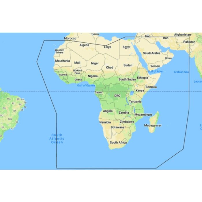
C-MAP® DISCOVER™ M-AF-Y050-MS: Africa & Arabian Sea Coverage
Explore the diverse and dynamic waters of Africa and the Arabian Sea with C-MAP® DISCOVER™ M-AF-Y050-MS. Tailored for those who seek to navigate some of the world’s unique and challenging marine environments, this chart offers comprehensive coverage and the essential features you need for safe and confident journeys. Whether you're cruising along the African coastline, fishing in the rich waters of the Arabian Sea, or sailing along key shipping routes, this chart delivers detailed and accurate information to enhance your experience on the water.
-
Key Features
-
Extensive Regional Coverage
Navigate the vast coastlines of Africa and the Arabian Sea with confidence, supported by detailed charts that include major ports, harbors, and key navigational features. -
Full-Featured Vector Charts
Access precise, up-to-date vector chart details derived from official Hydrographic Office sources, ensuring reliable navigation across diverse waters. -
High-Resolution Bathymetry
Identify critical underwater features such as reefs, drop-offs, and shoals with the integrated HRB layer, enhanced by quality-controlled Genesis® data, helping you avoid hazards and find the best fishing spots. -
Custom Depth Shading
Set a clear visual safety depth, maintain a traditional paper-like view, or create custom shading to suit your specific needs, whether you're exploring new areas or focusing on specific depths for fishing. -
Easy Routing™
Plot the safest and most efficient route automatically, based on detailed chart data and your vessel's specifications, with no subscription required. Ideal for navigating complex coastlines and busy shipping lanes. -
Tides & Currents
Plan your passage with detailed tidal information and current projections, crucial for navigating the dynamic waters of the Arabian Sea and African coast. -
Detailed Marina Port Plans
Docking in unfamiliar ports is made easier with precise layouts of marinas, including slip spaces, restricted areas, and other essential details. -
Harbor & Approach Details
Approach any harbor or inlet with confidence, thanks to the chart’s detailed depictions of these critical areas, ensuring safe entry and exit.
General Specification
No specifications available.
