


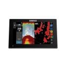
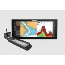
NSX 12'' Smart Chartplotter and Fishfinder - No Transducer

Stock Status: Out of stock
Note: Only quantities are available in stock. Currently out of stock. Please request a quote.
Description
Description
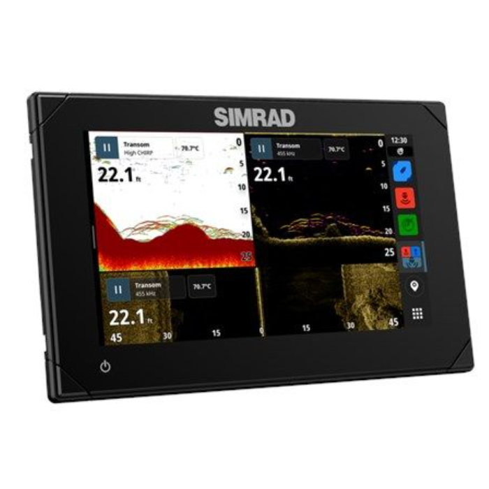
The future is here with NSX®. Experience the simplicity of Simrad’s latest operating system, introducing a redesigned charting experience, fastest-ever auto-routing, and seamless integration for total control of your boat. NSX comes fully-equipped with integrations for Sonar, Radar, and Autopilot Systems.
Crafted specifically for fluidity and ease of use, with NSX you'll spend less time on the screen, and more time on your next adventure.
With an innovative, modern interface featuring powerful navigation capability with C-MAP® support, you’ll see everything like never before. The NSX features integrated Sonar, full Radar and Autopilot systems compatibility, and with handy Setup Wizard tool, you’ll be up and running in no time. All you need to do now is choose your next on-the-water adventure.
Key Features
-
Sonar sharing
-
Full Mercury Integration, inc. SmartCraft® Connect and VesselView®
-
SolarMAX™ IPS HD touchscreen with extreme viewing angles
-
Compatible with Active Imaging™, featuring CHIRP, SideScan, and DownScan Imaging™, as well as the S3100 & S5100 sonar modules
-
Compatible with C-MAP® DISCOVER™ X AND REVEAL™ X charts
-
Support for additional charting, such as CMOR, Florida Marine Tracks, Strike Lines and Standard Mapping *US Only – to come in 2023*
-
See near and far with full HALO® radar support
-
Easy autopilot integration
-
Excellent third-party integration, inc. CZone®, OmniSense, Dometic, Lumishore and more...
-
Simrad® App integration
-
Wireless connectivity, plus full Ethernet, USB, and NMEA 2000® networking capability
-
IP Camera video support
-
New Setup Wizard to get you up and running quickly
General Specification
| Specifications | |
| Display | |
| Backlight Color | White |
| Display Resolution | 1280 x 800 px |
| Display Size | 12 inches |
| Screen Brightness | >1200 nits |
| Viewing Angles | 85° (top, bottom, left, and right) |
| Physical | |
| Compass Safe | 50 cm (1.7 ft) |
| Dimensions W x H x D | With bracket: W: 319.5 mm (12.58") x H: 215.1 mm (8.46") x D: 86.0 mm (3.38")No bracket, no suncover: W: 309.5 mm (12.19") x H: 208.4 mm (8.20") x D: 86.0 mm (3.38")No bracket, with suncover: W: 314.5 mm (12.38") x H: 213.3 mm (8.40") x D: 91.0 mm (3.58") |
| Mounting Type | Bracket (supplied), panel mount or flush mount |
| Weight | 2.2 kg (4.9 lbs) |
| Electrical | |
| Power Consumption max | 29.7 W (2150 mA at 13.8 V) |
| Recommended Fuse Rating | 3A |
| Supply Voltage | 12 V DC (10 - 17 V DC min - max) |
| Environment | |
| Humidity | IEC 60945 Damp heat 66°C (150°F) at 95% relative (18 hr) |
| Operating Temperature Range | |
| 15°C to 55°C (5°F to 131°F) | |
| Shock Vibration | 100,000 cycles of 20 G |
| Storage Temperature Range | -20°C to 60°C (-4°F to 140°F) |
| Waterproofrating | IPx6 and IPx7 |
| Connectivity | |
| Bluetooth | Bluetooth 4.0 with support for Bluetooth Classic |
| Ethernet Ports | 1 port (5-pin connector) |
| Connectivity Wi Fi | IEEE 802.11b/g/n |
| NMEA 2000 Connectivity | 1 x NMEA 2000 Micro-C port, 1 LEN |
| PC Connectivity | No |
| SD Card Storage | 1 MicroSD slot, USB port for external drive |
| Video | Ip Camera support |
| MFD | |
| AIS | Receive AIS data over NMEA 2000 |
| Cartography included | World wide basemap (not for navigation) |
| Digital Switching | Simrad command DDS only on release to market |
| GPS | Internal, 10Hz, WASS, MSAS, EGNOS |
| Sonar Compatibility | One 9 pin Xsonic 1 kW Sonar port. Single channel CHIRP, 50/200 khz, HDI, Active Imaging |
| Waypoints, Routes, Tracks | 6000 waypoints, 500 Routes with 100 max route points, 50 tracks with upto 12,000 track points. |
| Weather | No |
| GPS | |
| Correction | 10 Hz high speed update (internal)WASS, MSAS, EGNOS, GLONASS |
| GPS Receiver Channels | 32 Channels |
| Position Accuracy | Horizontal Accuracy 3 m (9.8 ft) |
| Update rate | 10Hz |
| Cartography | |
| Charts Supported | C-MAP Tile (CMT) Discover X C-MAP Tile (CMT) Reveal X |
| Other | |
| Interface | Multi-touch screen |
